Tuesday, August 3, 2010

Santa Ynez Trail

Santa Ynez Trail (2.2 miles) - Entrada Road, Topanga Canyon State Park

out of work = more hiking

Waiting at the parking lot due to a slight mix up about the entrance to the trail. I was at the wrong entrance.


Still waiting and wandering around the parking lot. Concerned about animals charging, I backed away back towards the car.


Finally realizing we were waiting at opposite entrances to the same trail, I started walking towards the group in hopes of meeting in the middle. I started taking pictures of the trail in case I needed to refer to them later when I inevitably got lost.


Found the group and backtracked to the lookout. Safety in numbers.


Looking out at Santa Ynez Canyon. Fancy, expensive homes in the distance....


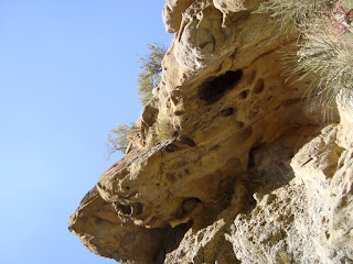
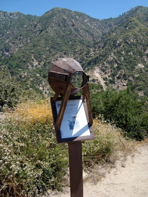
Is it a face in a sun, or a sun surrounding a face?


Message from the aliens. In case I did not know where I was, rest assured, I am here.

Hike rating:


3 out of 5 smores due to lack of promised waterfall


Saturday, June 19, 2010

Runyon Canyon

Runyon Canyon (3.0 miles) - Mulholland Drive, 2.6 miles east of Laurel Canyon

Rules of Runyon Canyon:
1. The prettier the person the uglier the dog.
2. You will get passed by either a pregnant trophy wife or a child in the 5-7 year old range. This will make you feel really bad about yourself.

3. At one point you will find yourself behind someone that has let their dog roam free yet is surprised when the dog runs away (today's lost dog: Lucky)
4. Unlike other hikes that allow you to feel like you are in the wilderness, this hike will constantly remind you that you are in LA.
5. Do not make eye contact with other hikers. If you do it will cause your face to melt like in Raiders of the Lost Ark.

and now to the hike......


In an attempt to avoid the most amount of people I was out the door by 6:30AM and made it to the parking lot by 6:42. The parking lot was almost full and there were dogs everywhere. Seriously? Why are you awake people? It's freakin' Saturday.


Heading up towards Indian Rock. I'm not sure if this is the actual Indian Rock or just a random rock. Either way someone has labeled it in case you missed that chapter in 1st grade earth science.


Most people think there are only two ways to hike runyon. You can either go east and take the stairs or go west to the steep side. Today I learned there is a secret option #3 that runs right down the middle of the canyon. Leave it to me to find a way to get lost in runyon.


At this point I was scrambling down the mountainside and slipped on some loose dirt. I did one of those cartoon falls where your legs fly up and you land flat on your back looking up at the sky wondering what just happened.


I brushed myself off and attempting to get back onto the real path from secret path #3.


I'm not sure if this guy's name is Alec, the artist's name is Alec, or both. To me he kinda looks like Jack Nicholson.


"My second piece of advice, have as many kids as you can, 'cuz that makes it more likely that one of those kids'll grow up and make it big in Hollywood. Then who's payin' the bills huh? Hollywood Kid. Class dismissed."


You can kind of see downtown in the distance and somewhere in the middle there is my old apartment. I bet a homeless person is peeing in the north stairwell right now.


Someone decided to paint their deck with green screen paint, proving once again that money can't buy good taste.


Stopped on the way home at the Universal City Overlook. Five minutes after I left the sun came out. Figures.


Hike rating:


2.5 out 5 Bea Arthurs due to oversaturation of people, dogs, dog poo, and LA bullshit

Friday, June 18, 2010

Towsley Canyon

Towsley Canyon Loop (6.5 miles) - Calgrove exit off the 5 in Santa Clarita

Start of the trail. 0.1 miles down. 6.4 to go.


This is what happens when the ground throws up. Also future site of Volcano 2: Volcano takes Santa Clarita


About halfway up the mountain looking back towards the 5. Little trivia for ya, did you know that the 5 freeway is the only prime number freeway in Southern California?* (* not actual fact)


This picture belongs on the label of a beer called something like Weissinheferzizen.


I'm calling this one artistic expressionism.


All dressed up with nowhere to swim.


I was sort of hoping that this tree would rip itself out of the ground and start walking like in Lord of the Rings. It did not.


I can't decide if this looks like a dog or a Dutch clog. Either way, worst Rorchach test ever.


Hanging out on the sandstone walls of awesomeness and looking down onto what should be a river.


Hike rating:


4 out of 5 angry pig heads.


Tuesday, June 15, 2010

Echo Mountain

Sam Merrill Trail - Echo Mountain (5.0 miles) - Lake Ave exit off the 210 in Pasadena

Today's hike is the first in a series of what I like to call The Unemployment Chronicles and it brings us to Altadena (aka the poor man's Pasadena, aka the town named after the milk, aka where is that place again? Is that anywhere near Glendale?).


I could have easily gotten the same picture standing in line at Big Thunder Mountain Railroad at Disneyland but it would have cost me $72 and a small part of my soul.


This is what I like to call a metaphorical bullshit picture in which I am stopped in time between where I came from and where I want to be. That's the kind of stuff you can only get from a freshman year Psych 101 elective class..... or a fortune cookie.


While this plaque makes it look super important there are actually over 80,000 places listed in the National Register of Historic Places. Some of them are diners. You make your own conclusion.


Made it to the top only to find what appears to be a giant's junkyard.


Ruins of the Echo Mountain House Hotel. Perhaps building a hotel 1400 feet up a mountain was not the best business plan.


Some sort of campfire/hippie party area. Open letter to hippies: Don't leave your beer cans/plastic bags/cheetos bags on the ground at the top of a mountain. It ruins it for the rest of us that are contributing members to society.


Echo phone! If you yell profanities into echo phone you can be sure to destroy the innocence of small children somewhere on the mountain.


The view from the top that sums up the whole smog situation we have here in LA. Don't worry, if the smog doesn't get you eventually the earthquake will.


And finally a good lesson for all of us from our friend Smokey the Passive-Aggressive Gas Mask Bear: Remember! only you can cause(prevent) forest fires.


Beer can count: 6
Snake count: 0

Hike rating:


4 out of 5 Stewies